Site Scouting
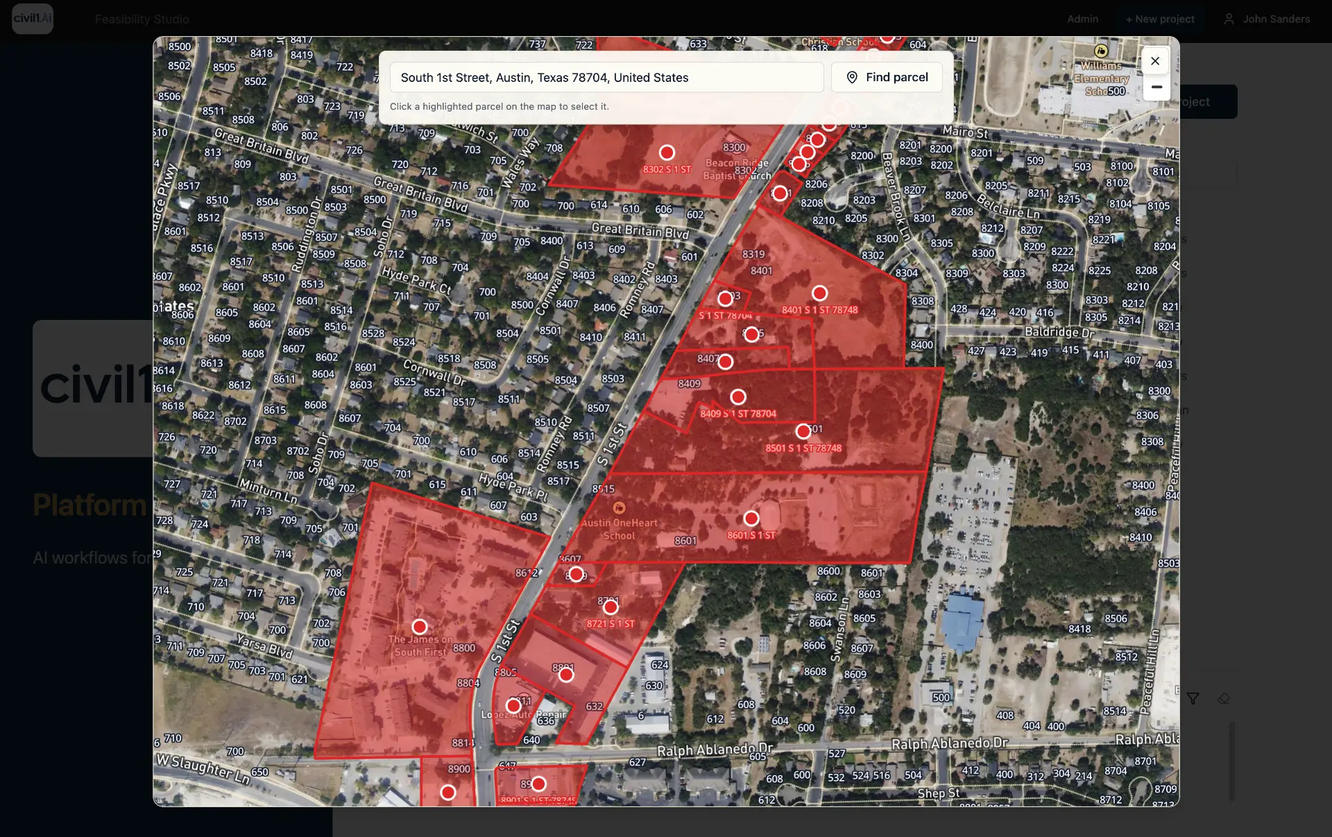
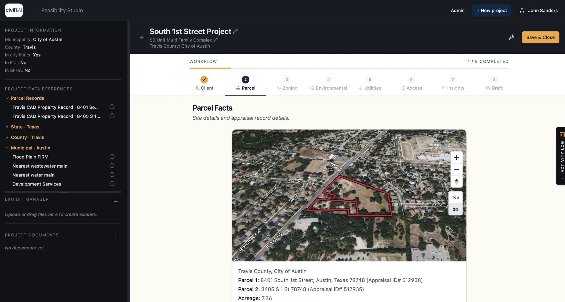
Map search by address or parcel ID.

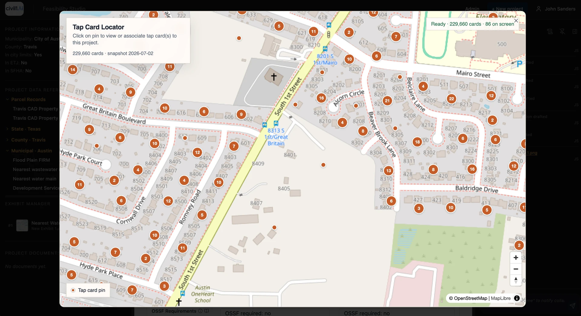
AI enabled site investigation tools for land development.
PROVEN RESULTS
5
minutes
Time to first screen
2
weeks
Manual site investigation baseline
FOR LAND DEVELOPERS
Know your net yield, cost structure, entitlement timelines and project risks before you commit commit.
FOR CIVIL ENGINEERS
Know and document project constraints and risks up front.
FOR PERMITTERS
Reduce permit delays with feasibility analyses that flag project constraints and risks up front.
The diligence window
Any AI tool provides quick answers. Only one covers the subject areas with hyper-local, verified data.
Investigation begins
Subject areas indexed
Decision point
With sources in hand
THE FEASIBILITY STUDIO
Scout addresses and parcels, create a collaboration project, and generate reviewable site studies grounded in cited facts and insights. In minutes...
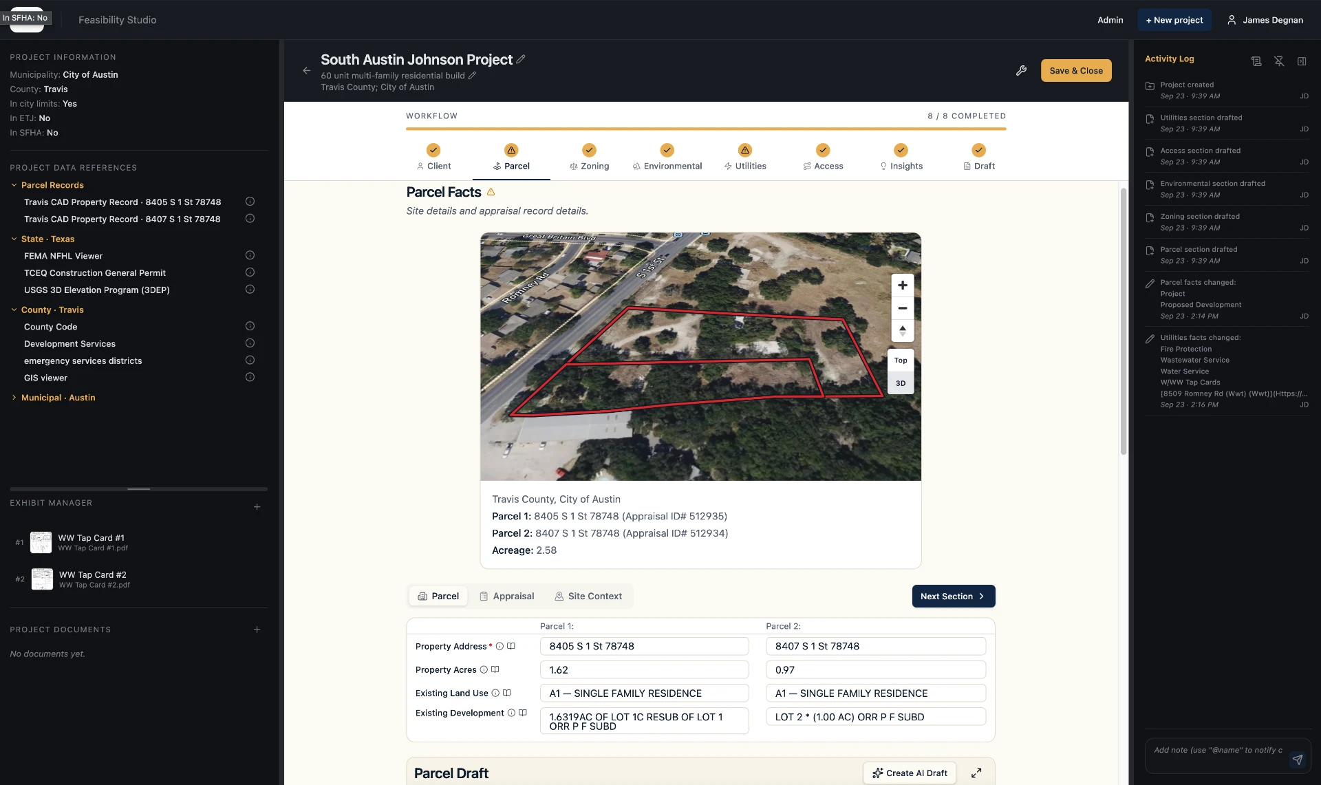
Map search by address or parcel ID.
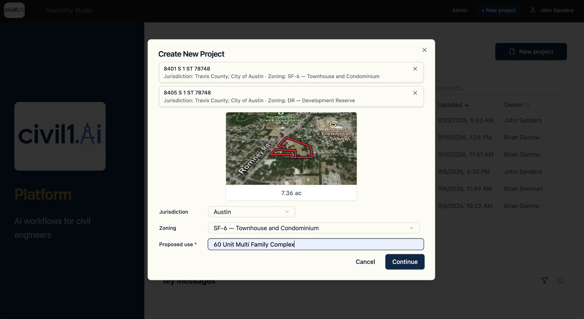
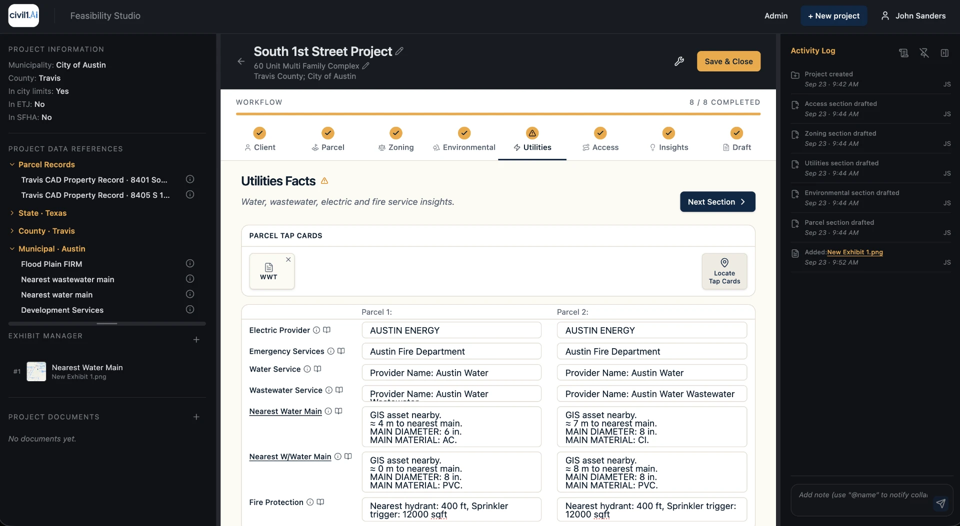
Team collaboration and message features, documents management.
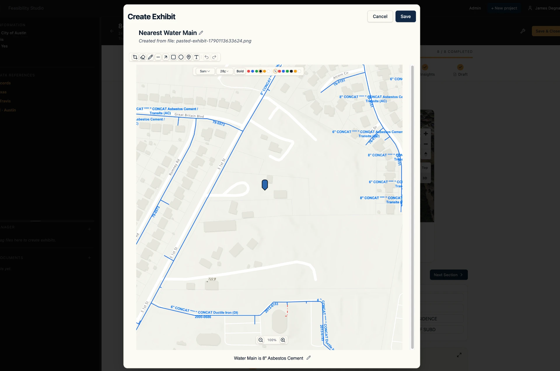
Create or upload exhibits in minutes.
Acreage, land use, legal description, valuation, year built, and deed reference come from the county appraisal district.
City limits, extraterritorial jurisdiction, county-only, permitting authorities.
Test current district standards, lot size, setbacks, height, coverage, and impervious cover.
FEMA floodplain, watershed, aquifer zones, soils, and topography.
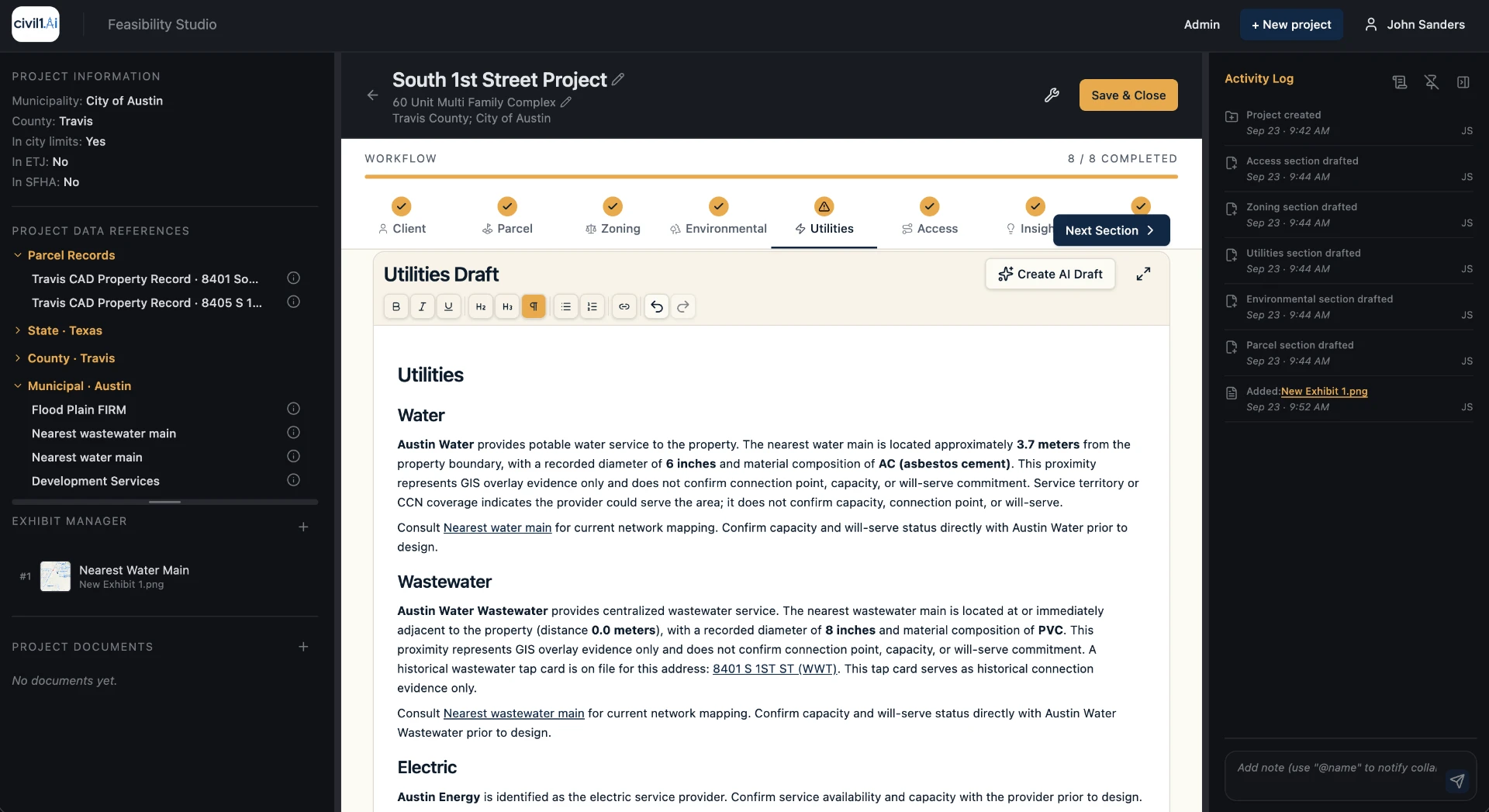
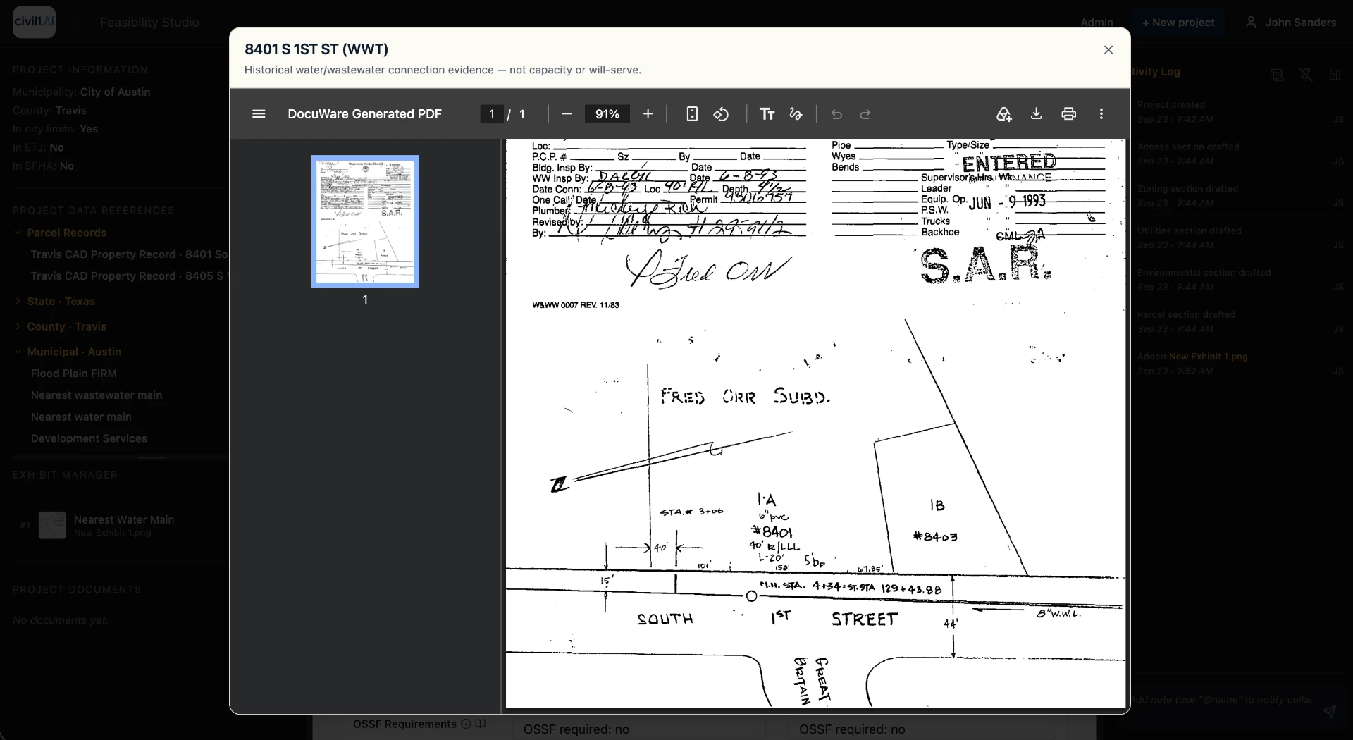
Nearest water and wastewater mains, service area providers, the nearest mapped mains, tap cards.
Right-of-way, road classifications, emergency services district, on-site sewage requirements.
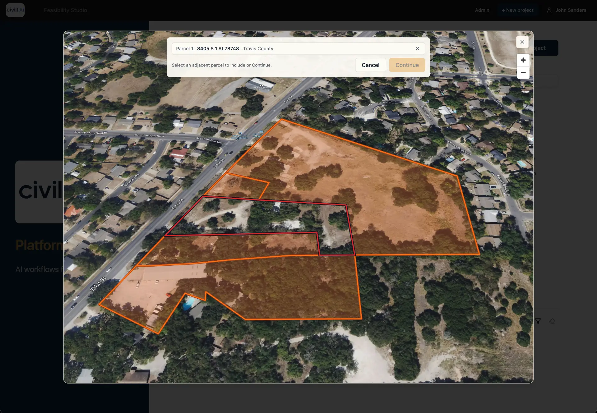
Evaluate adjacent parcels as a single, unified site study.
Generate professional, shareable site investigation summaries.
The civil1.ai Platform
Municipal code & ordinances
LDC text
Zoning & overlay districts
Jurisdiction GIS
Utility service areas & capacity
Provider records
Flood & environmental layers
FEMA FIRM · watershed · habitat
Parcel, plat & deed records
County records
Roadway & transit plans
State / MPO GIS
Flood zone
FEMA FIRM panel
Impervious cover limit
Municipal code §
Wastewater service
Provider service-area record
Environmental overlay
Intersects 6.2 ac of the parcel
Roadway access
Gap flagged, not inferred
Boundary, acreage, plat and entitlements
Jurisdiction, district, overlays, setbacks
Water, wastewater, service area
Floodplain, watershed, aquifer and habitat overlays
Frontage, access, roadway plans
The fiction and truth about AI site screening
One indexed page. Every claim gets its own anchor, so the correction sits next to the claim wherever it's read. Read the full fiction and truth page.
Claim
AI can tell you whether a site is developable.
Fact
Any model can draft an answer. Civil1.ai provides hyper-relevant data and insights an engineer can stand behind.
Claim
The data is public, so this problem is solved.
Fact
Manually collected public data is highly fragmented, time consuming, and prone to error. Civil1.ai manages this for you allowing you to focus on getting the answers you need.
Claim
Speed is the whole value.
Fact
Speed without data quality and accountability just moves the risk earlier in the deal. Civil1.ai's site data review and audit capabilities eliminates this risk from your decision process.
Our Team

Founder & CEO

Chief Data Officer & Head of Technology

Head of Strategy
Questions